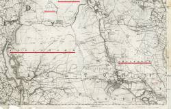


Picture MAP 1849 Anglezark & Longworth
This picture was taken in 1849 in Anglezarke.1Picture Notes
1849 map showing Anglezarke and Longworth; North Turton; Wheelton Moor and Withnell Moor. Longworth Hall, Ease of Belmont is circled.
https://maps.nls.uk/view/102343997
Technical Data
Dimensions: 1248x792 pixels (0.98 MegaPixels in total) Size: 549KB 96dpi 24 bpp, source file: ..\Scans\Maps\Bolton\1849 Anglezark & Longworth.jpg
- References (4)
- Place: Anglezarke
- Place: Longworth
- Place: Wheelton
- Place: Belmont
This page is within a frameset. View the entire genealogy report of , or surname index or report summary.
Family Genogram.
Copyright © 2011 GenoPro Inc. All rights reserved.
